Salt Lake
West Side Stories


A Blog Series about the History of Salt Lake's West Side


Image Gallary


Salt Lake West Side Stories include historical photographs and sketches that aids in visualizing the history of the Pioneer Park neighborhood. The images are arranged in the order they appear in the blog series. We invite you to explore the history of Salt Lake City's old west side (the Pioneer Park neighborhood) by taking a tour of this gallery. 

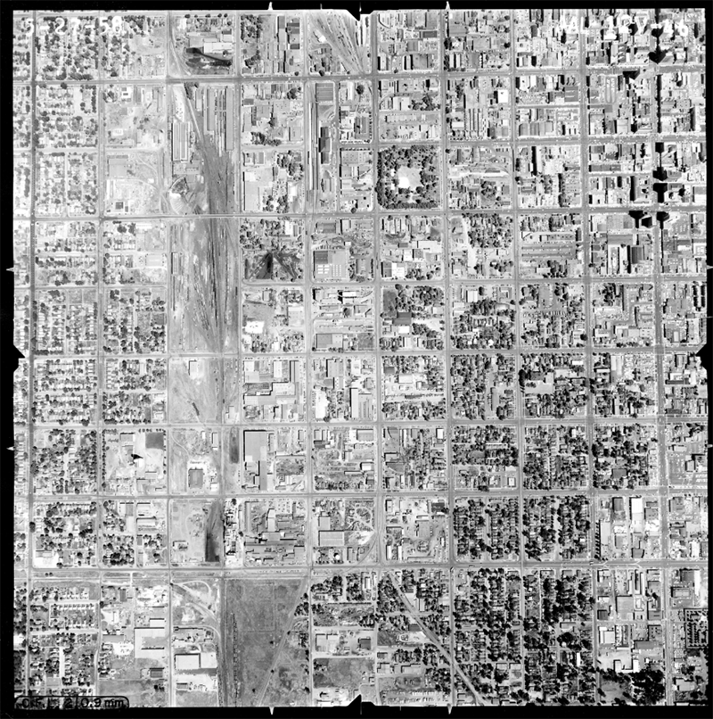
Image 1: Pioneer Park Neighborhood Boundaries, pre-1971 Street Number, circa 1958


Image

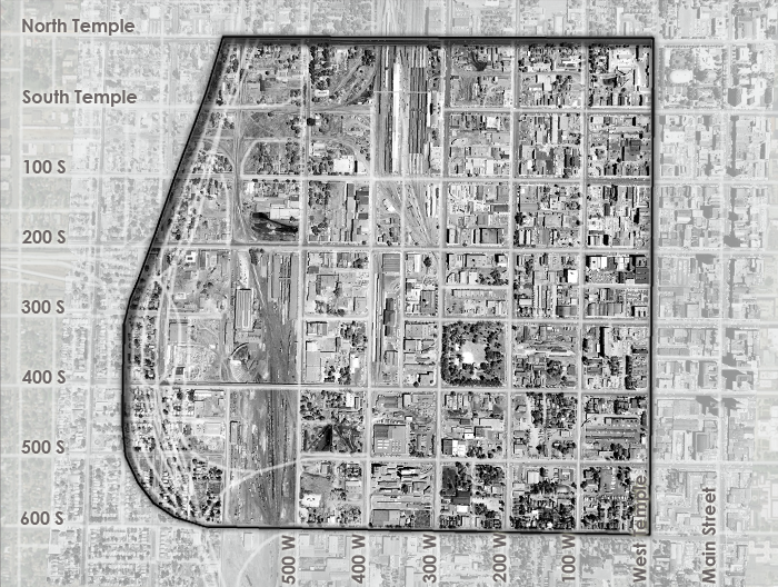
In 1973, Salt Lake City changed the names of its of its North and West Streets. Initially, street numbers increased or decreased beginning with the the city's meridian, or Temple Square. However, Main Street, which was originally called East Temple, along with North and West Temple did not align with the other street numbers along the grid system. In 1972-1973 West Temple became 100 West and the original 100 West street became 200 West. By making this change all of the street numbers and individual addresses matched.

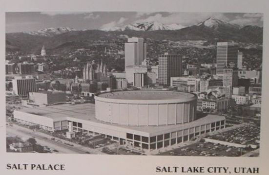
This aerial photograph was taken prior to the construction of Interstate-15, the Salt Palace (now the Calvin L. Rampton Salt Palace Convention Center,) and the Vivint Smart Home Arena.


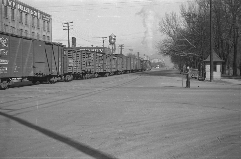
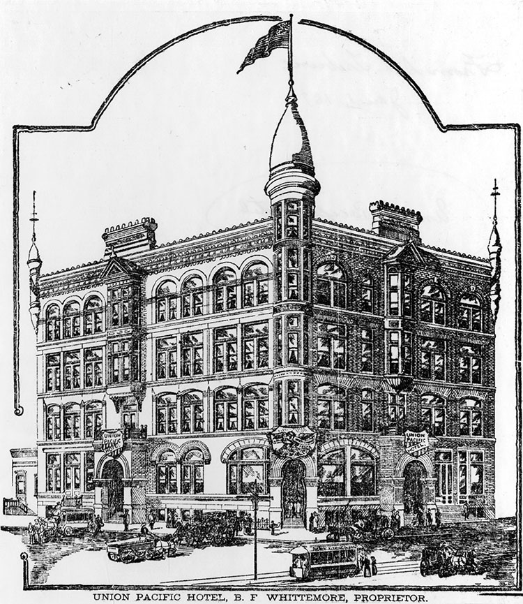
Image 2: Union Station used for the Oregon Short Line Railroad and the San Pedro, Los Angeles, and Salt Lake Railroad, both subsidiaries of Union Pacific, 400 West and South Temple, Salt Lake City, November
1910; Shipler Commercial Photography, Utah State Historical Society.


Image
The previous depot was located north of the current station between South and North Temple Streets. This new station, completed in 1908 was placed directly in the middle of South Temple, creating a terminating vista, and making the new station an instantaneous landmark seen down South Temple. Although aesthetically pleasing, the dead ending of these streets, along with the north–south railroad track corridor, and the later Interstate-15, created and reinforced the east-west divide of Salt Lake City.


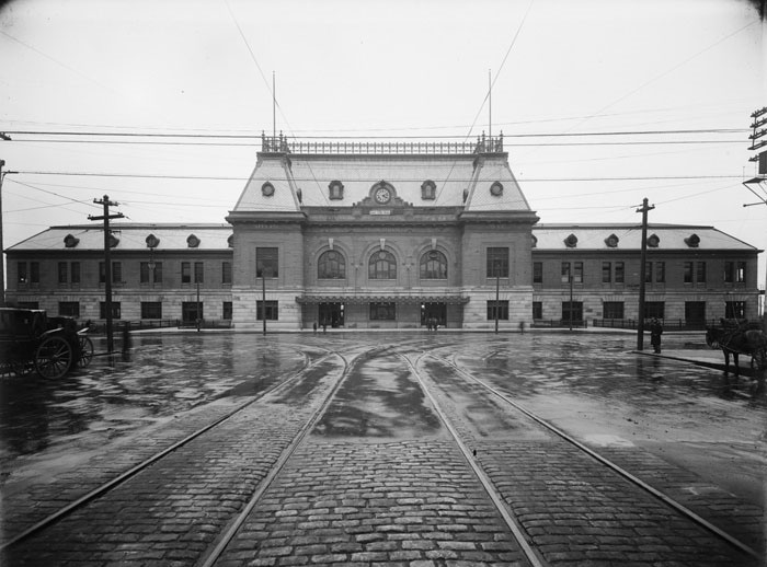
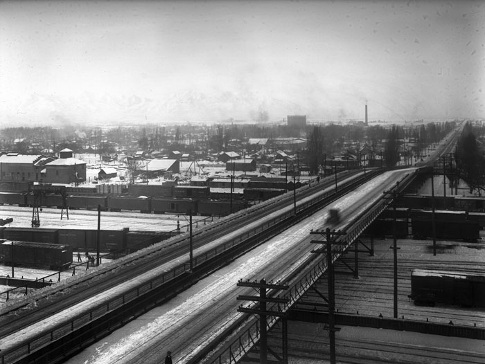
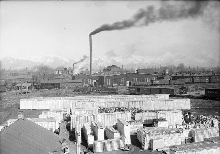
Image 3: The Denver and Rio Grande Railway Station, 300 S. Rio Grande Street, Salt Lake City, August 18, 1910


Image
The image includes all the possible means of transportation when you or your freight arrived in 1910 Salt Lake City, including (left to right) a dray freight wagon, a spring wagon, and a series of four-wheeled Landau (with convertible tops) and Clarence (with hard top) carriages, an early automobile, an open automobile touring bus and a Utah Light & Railway Company electric trolley. Thanks to Eli Anderson and Wagon Land Adventure (Tremonton, UT) for the wagon type identification.
Image 4: Looking southwest across the Great Salt Lake City, from the roof of Temple Square’s first tabernacle, circa 1865; Charles W. Carter, photographer; courtesy of Chris Reder, digital image furnished by Ronald Fox.

Image
The ordered Mormon agrarian village is evident in this photograph, with ten acre blocks, four lots to a block, with wide tree-lined streets; with barns, out-buildings, orchards, gardens and outhouses. The image was taken before the Salt Lake Courthouse was completed in 1866.
Image 5: Looking southwest across the Great Salt Lake City, from the foothills at approximately 200 North Main St., circa 1867-1869; Charles W. Carter, photographer; Courtesy of Chris Reder, digital image furnished by Ronald Fox.

Image
The yet to be channeled Jordan River and river bottoms may be seen in the distance, along with the Salt Lake County Courthouse (the largest building to the right, at 156 West 200 South) and the recently completed second Salt Lake Tabernacle (far left center, completed 1867 on Temple Square). This is pre-railroad Salt Lake City, prior to January 1870.

Image 6: Fur Trapper Rendezvous, Upper Green River, Wyoming, William Henry Jackson, artist.

Image
Image 7: Mormon Immigrants’ first view of the Salt Lake Valley, traveling down Emigration Canyon; William Henry Jackson (1843-1942), artist; painted circa 1930s; black and white copy, Utah State Historical Society.

Image
Jackson spent a lifetime documenting the story of the American West with illustrations, drawings, and photographs. This illustration offers a general–not entirely exact–representation of what the Utah pioneers would have seen, entering the Salt Lake Valley: gentle westerly declines, tall grasses, marsh land and wandering creeks.

Input your text here! The text element is intended for longform copy that could potentially include multiple paragraphs.

Image
Image 8: Fort, Great Salt Lake City, Utah, 1848; taken from "The Works of Hubert Howe Bancroft, History of Utah, 1540 to 1886," Volume XXVI, The History Company, Publishers, San Francisco, 1889. In general outline, this sketch is correct, notwithstanding the far-too-close and out-of-scale mountains. The fort would have also included interior corrals and acres and acres of freshly tilled and furrowed fields around it.

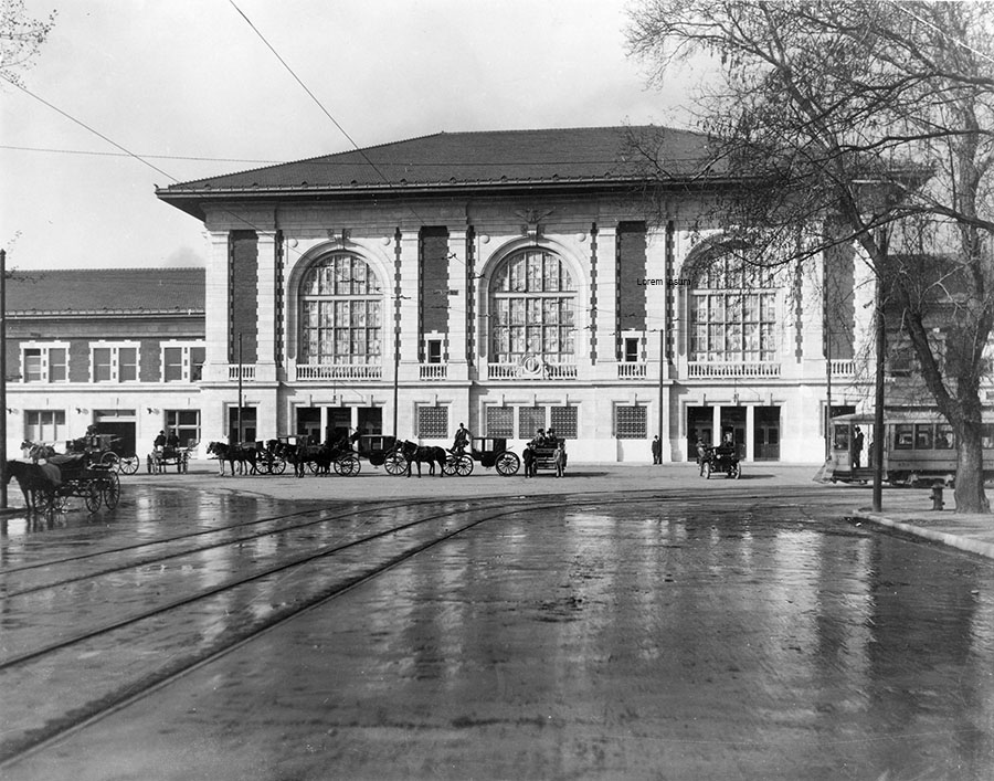
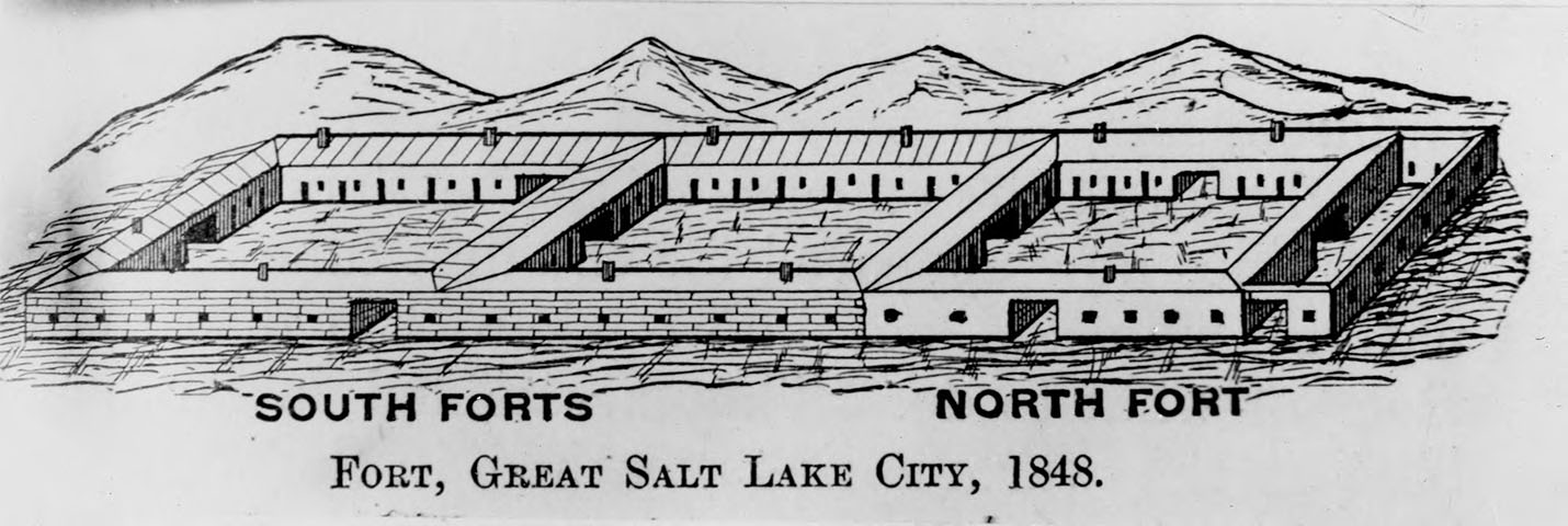
Image 9: Fort on the Great Salt Lake; rendered by Kirk Henrichsen, circa 1995; used with permission of the artist.


Image
An artist’s reconstruction based on Henrichsen’s and Salt Lake City historian W. Randall Dixon’s research into early Salt Lake City. The sketch is the most accurate drawing of the fort, which extended from 300 to 400 West and 250 South to 600 South. Click on the image and examine all the details, including log and adobe cabins (used also as fort walls), gateways, hundreds of wagons used for cooking and sleeping (inside, under and around), the flagpole and the animal corrals.

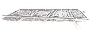
Image 10: Map showing the location and context for Salt Lake City’s first cemetery (near 300 South and 200 West), Office of Public Archeology, Brigham Young University, from "At Rest in Zion, The Archaeology of Salt Lake City’s First Pioneer Cemetery," Occasional Paper #14, 2011.


Image
During routine excavation for a new apartment building on July 6, 1986, a wooden coffin was uncovered, which led to the rediscovery of Salt Lake City’s first pioneer cemetery. During the ensuing archeological investigation, it was discovered that the land had been used for earlier burials (700 to 1200 years earlier). The second geographical reference on South Temple Street included another area of archeological study.

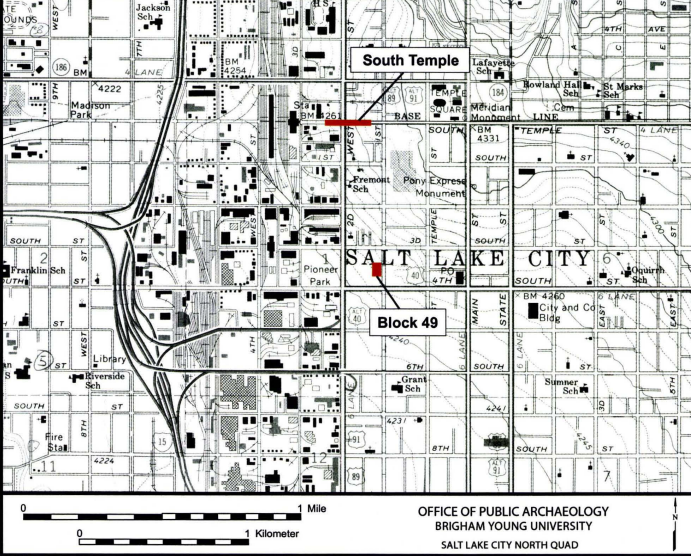
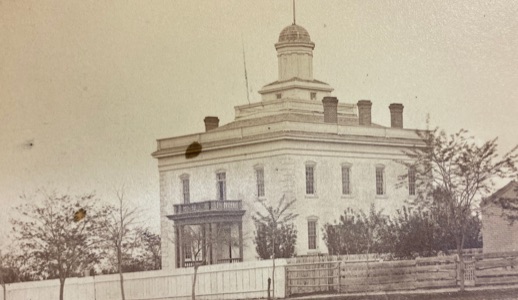
Image 11: Salt Lake City's Hall of Relics, Utah’s Pioneer Jubilee (1847-1897), circa 1897-1898; corner of South Temple and Main Street; Salt Lake Tribune Collection, Utah State Historical Society.


Image
With much gravitas Utah’s Hall of Relics was built as a smaller replica of the Parthenon in Greece. Along with its classical theme, the hall included a wagon and horse team in its tympanum (triangle pediment) and a replica of Ralph Ramsey’s flying eagle sculpture, seen atop Brigham Young’s Eagle Gate. The hall was temporary, built of plaster, cement, and jute fiber over a frame substructure. Built for the 50th anniversary celebration of the coming of the Utah pioneers, the building displayed hundreds of relics or artifacts. It was during and after this anniversary and celebration that Utah’s leaders took renewed interest in preserving the pioneer fort block.


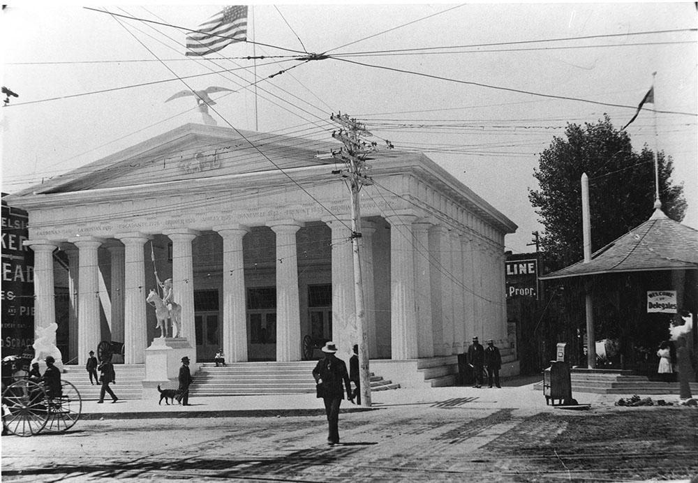
Image 12: Milton R. Hunter (center), flanked by Mr. Morgan and Mr. Giles, points to the newly reinstalled Pioneer Fort monument (a bronze plaque, No. 23 erected originally in 1933); December 26, 1953; Salt Lake Tribune, Utah State Historical Society.


Image

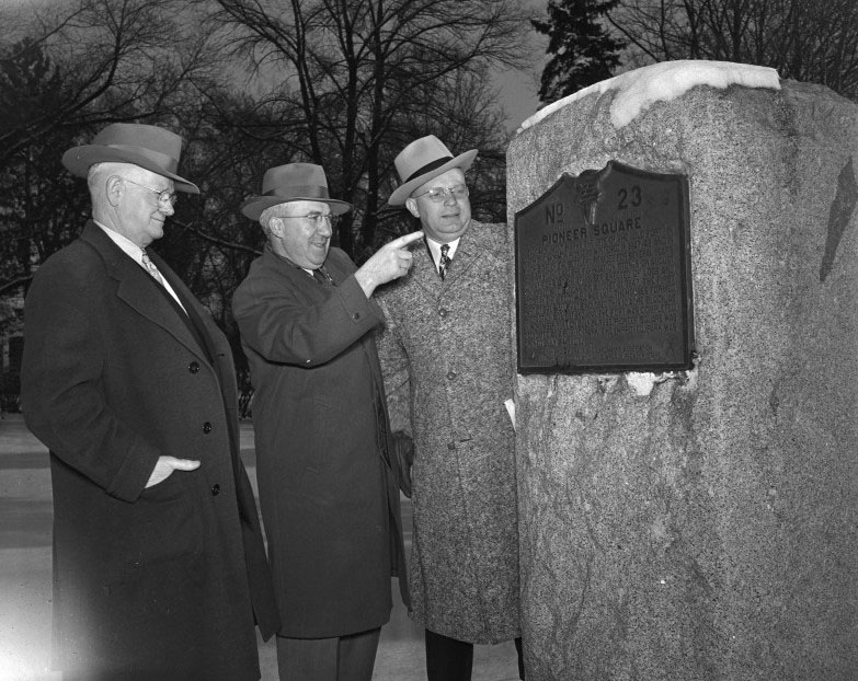
Hunter, a Ph.D. in History from UC Berkeley, was a longtime LDS Church Education employee and popular Utah history author, two of his books including "Brigham Young the Colonizer" (1940) and the "1847-1947 Utah Centennial History: The Story of Her People." Although academically trained as a historian, Hunter was a proud Utahn and an unfailing defender of his church. Unfortunately, Hunter's writings about Utah’s Native Americans were often belittling and dismissive. In his official centennial history he made no mention of Utah’s non-Mormon immigrants from central and eastern Europe, or from Asia, Mexico or any other non-Mormon multi-generational citizens of color.

Image 13: One of Salt Lake City’s oldest and newest buildings, circa 1965; Hal Rumel, photographer; Utah State Historical Society.


Image
The copper-clad, eighteen-story Kennecott Building, completed in 1962, located on the southeast corner of South Temple and Main Street, served as a grand mid-century comparison to the humble mid-nineteenth century Osmyn and William Deuel log cabin built in 1847 within the Pioneer fort. From the 1930s to the 1970s, the humble one-room cabin was displayed under a white neoclassical pavilion with a surrounding wrought iron fence. Its site on Temple Square, gave the little cabin the sense of being a holy relic preserved in a shrine or reliquary. Today the cabin sits under the stars in a garden setting between the LDS Church’s Family History Library and Church History Museum on West Temple.

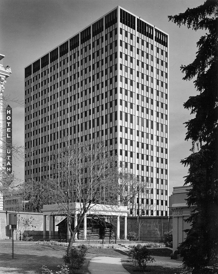
Image 14: Utah Central Railway’s (Ogden to Salt Lake City) “last spike” ceremony held behind and north of the present Union Pacific Depot), Salt Lake City, January 10, 1870; photographer unknown, International Society of Daughters of Utah Pioneers. This image was identified as the UCRR “last spike” ceremony by photographic historian Ronald Fox.


Image
Built by The Church of Jesus Christ of Latter-day Saints between March 1869 (the month of incorporation) and its “last spike” ceremony on May 10, 1870, the Utah Central Railway (UCRR) linked Utah’s capital city to the nation’s first transcontinental railroad. When this road was completed, it connected Salt Lake City to markets in the Pacific west, the Midwest and the eastern United States. Utah and the Pioneer Park neighborhood would never be the same again. The railroad brought incoming church converts, as well as merchandise, industrial goods and tourists. It also made the goal of one monolithic, relatively isolated, theocratic community of saints, far more difficult to accomplish.


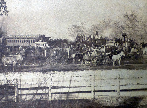
Image 15: Dr. John A. Widtsoe stands at a marker commemorating the spot were Gold Was discovered in 1848, May 13, 1940. Courtsey of the Utah State Historical Society.


Image
Input your text here! The text element is intended for longform copy that could potentially include multiple paragraphs.

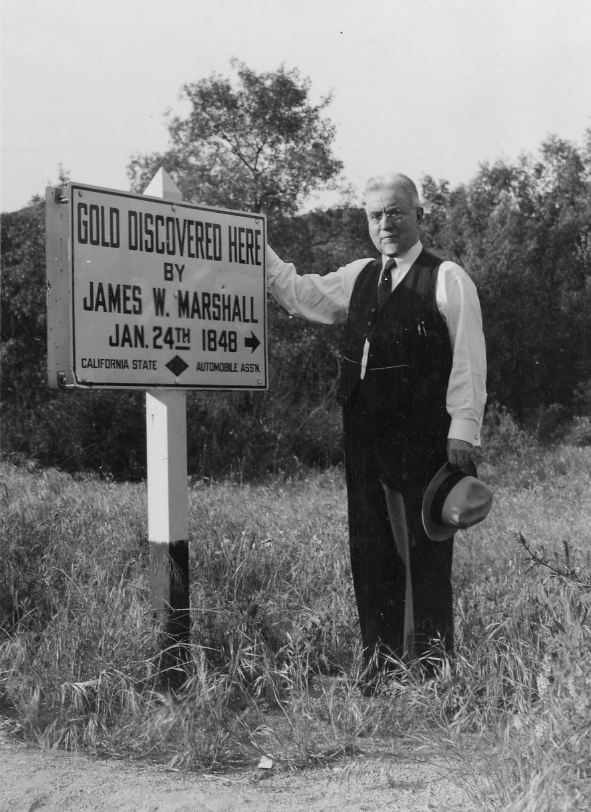
Image 16: A sketch of Sutter's Mill located in Caloma, California.
Courtsey of the Utah State Historical Society.


Image

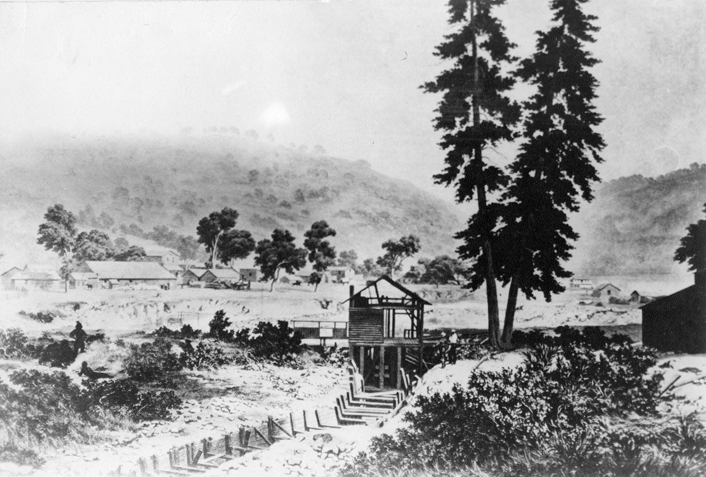
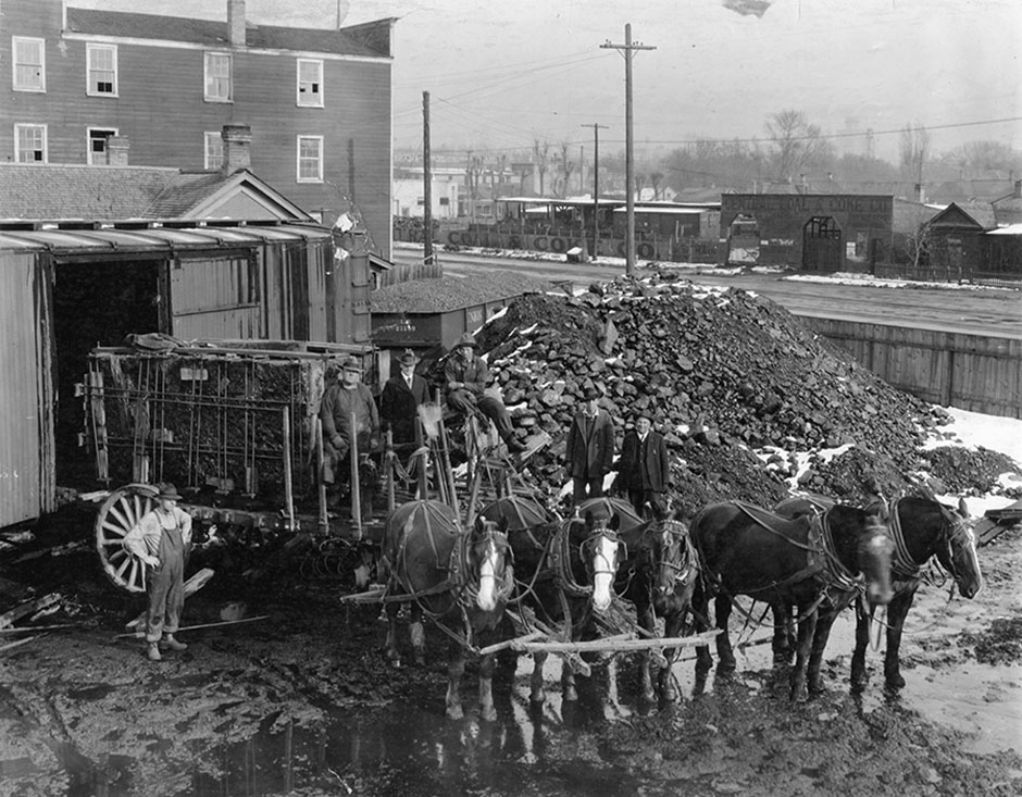
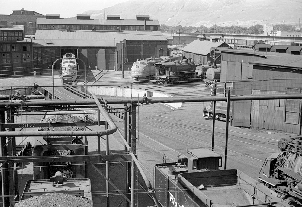
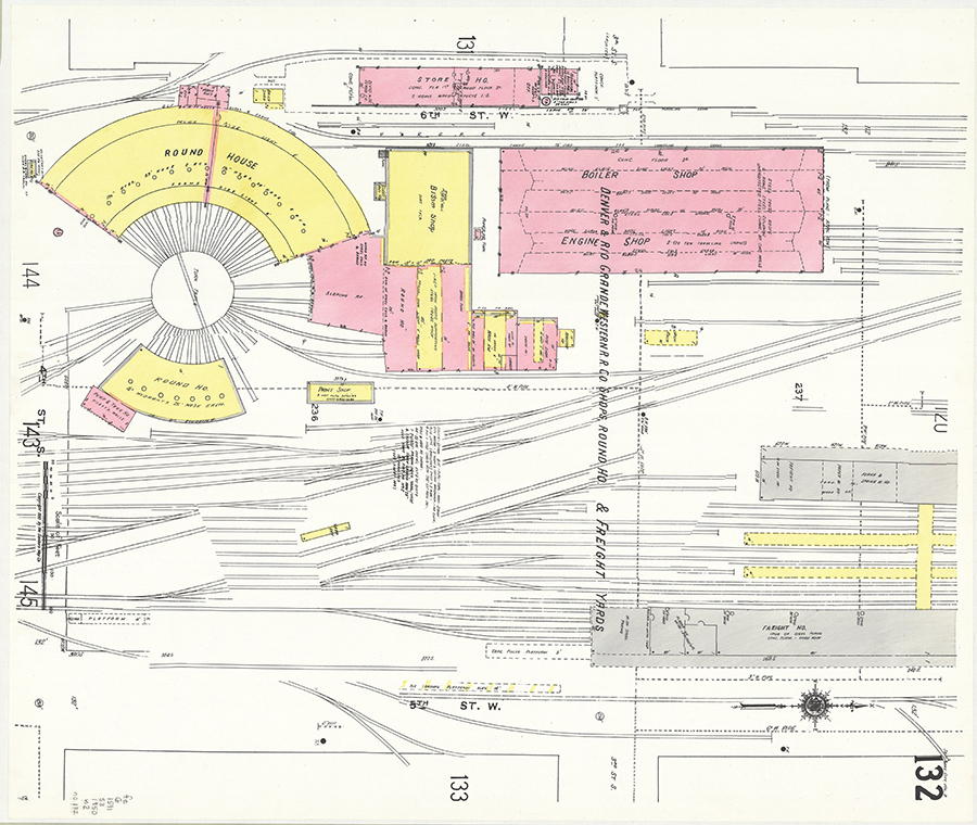
Image 17: Utah Central Railway locomotive #10 and roundhouse, Salt Lake City, circa 1880; F. I. Monsen & Co., photographer, Utah State Historical Society.


Image
The Utah Central Railroad's roundhouse was located on the northeast corner of the block bounded by North Temple and South Temple streets, and 400 and 500 West streets. The railroad's depot was located on that block's southeast corner. The innovative and society changing technology, the imprint of industrial development, was felt strongest and first in Salt Lake City’s Pioneer Park neighborhood.

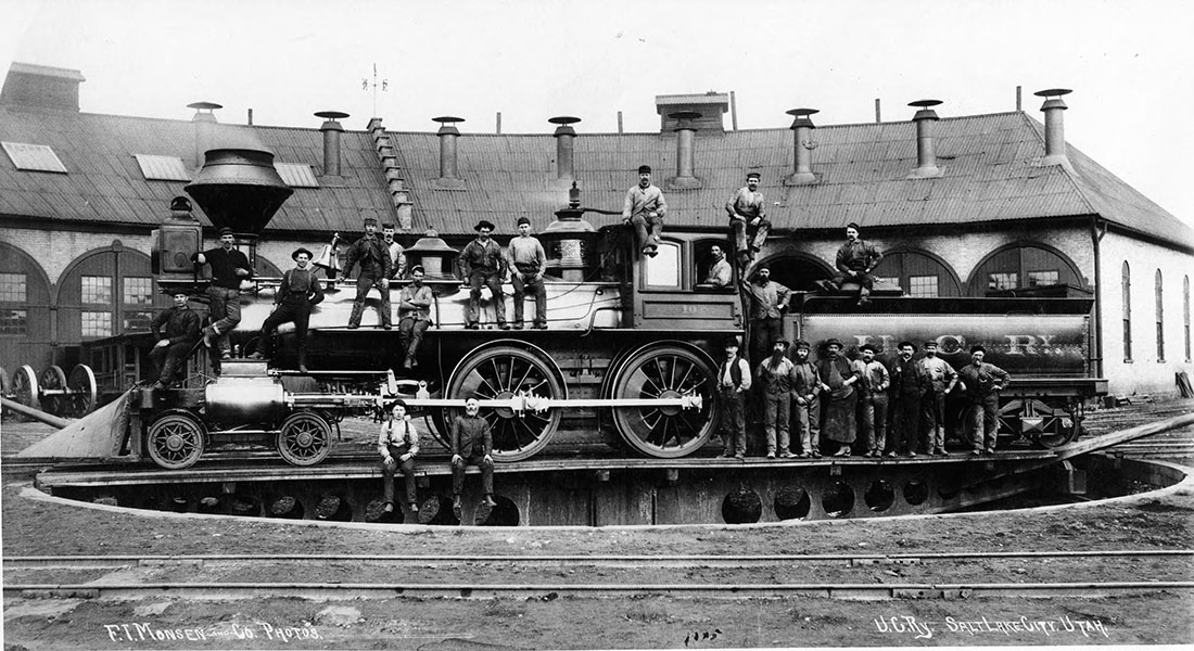
Image 18: Utah Central Railway (U.C.Ry) locomotive and workers; circa 1881; photographer probably Charles R. Savage; Utah State Historical Society.


Image
Locomotive #16, seen in this photograph, was formerly known as Union Pacific (UP) locomotive #123. It came to Utah in 1879 as part of UP's investment in the Utah Southern Railroad, the first railroad from Salt Lake City to central Utah. Utah Southern became part of the Union Pacific-controlled Utah Central Railway in 1881. UP merged all subsidiary railroads to better compete with the newly completed Denver & Rio Grande Railroad. After 1881, the Church of Jesus Christ of Latter-day Saints continued to own stock in the UP system, but no longer acted as owner-operator of the roads it had previously built. Thanks to Don Strack and UtahRails.net for the equipment identification.
Image 19: Birds-Eye View of Salt Lake City, Utah, from the North, Looking South-East, 1875; 2nd edition; Eli Sheldon Clover (1844-1920), Strobridge & Company, Lithographers; Geography and Maps Division, Library of Congress, Washington, D.C. You may click on this image to examine this drawing in closer detail.

Image
Drawn only five years after the completion of the Utah Central Railway, this illustration shows the depot and maintenance buildings all aligned via South Temple Street with Temple Square and the Church’s administrative hub. The pioneer fort square further right and towards the top has a Utah Southern Railroad train passing next to it.

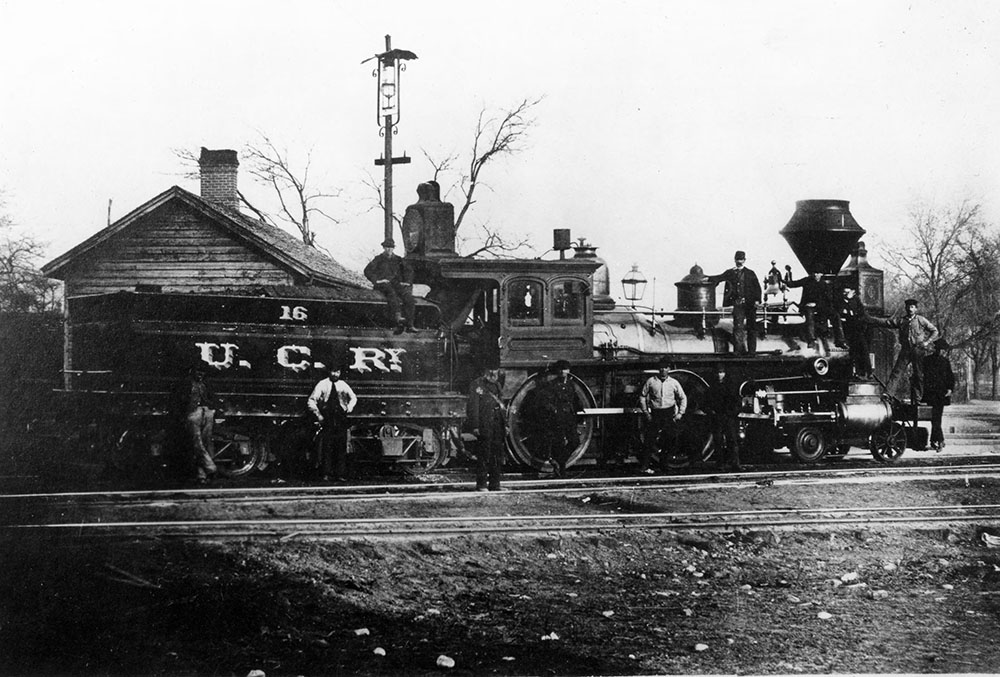
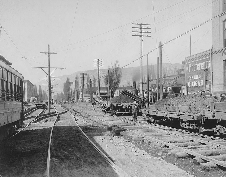
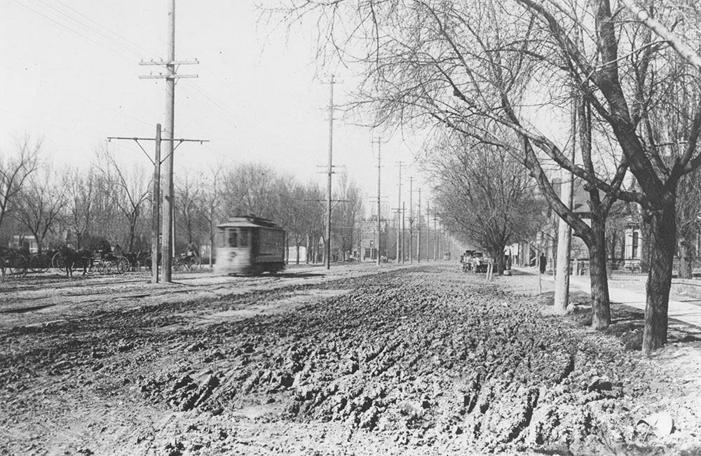
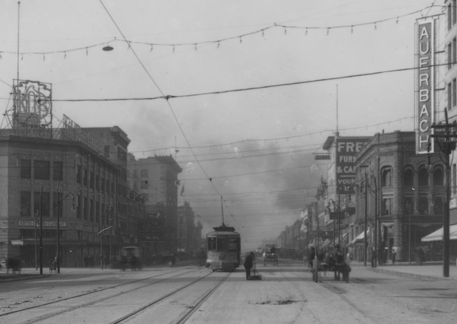
Image 20: 400 West, looking north to North Temple and beyond, circa 1907-1909; with train and trolley tracks nearly covering the street; Utah State Historical Society.


Image
This image illustrates the extent that tracks and railroad equipment permeated much of the Pioneer Park neighborhood. To the left, the double tracks and an electric trolley car are owned by Utah Light & Railroad Company. To the right, the tracks are owned by the Salt Lake & Ogden Railroad (SL&OR), a line that started as the Great Salt Lake & Hot Springs Railroad in the 1890s which eventually became the Bamberger Interurban Line. The dirt ballast in and around the SL&OR tracks is being removed and replaced by more permeable gravel. The Salt Lake Hardware Company building (which is still standing), located on 155 North 400 West, is at the upper left corner. Behind the center open railroad car is the SL&OR ticket office. A sign on the ticket office announces “Day Trips to Lagoon,” attracting workers and their families to flee the city for the amusement park in Farmington. Both the railroad and the amusement park were built and owned by Salt Lake City industrialist and later Utah Governor, Simon Bamberger.


Image 21: Railroad viaducts of the Pioneer Park neighborhood, circa 1913-1915; 400 South Street viaducts built by the Denver & Rio Grande Western Railway; Salt Lake City Engineers Department, Utah State Historical Society.

Image
The vast widths of these railroad yards are evident in these photographs. The viaducts were built and maintained by the railroad companies to cross their respective tracks. They included two trolley tracks and a two-car width road. Today this would be considered, in its width, a one lane road. In the above photograph you can see the roof line of the Denver & Rio Grande Western Railway Depot, built in 1911. Interstate 15, built in the early 1960s, generally followed the same transportation corridor, replacing these viaducts with larger concrete bridges over the railroad yards, along with additional viaducts or overpasses at 500 and 600 South.
Image 22: Viaduct or bridge crossing the rail yard at North Temple Street, built by the Oregon Short Line Railroad (Union Pacific).

Image
Image 23: Extended view of the Oregon Short Line Viaduct, looking northeast, 400 West No Temple, 1912.

Image

Image 24: Salt Lake City Greyhound Bus Depot (formerly the Interurban Trains Station); February 1953, southwest corner of Main Street and South Temple, Salt Lake City; Shipler Commercial Photography, Utah State Historical Society.

Image
During the interurban train era (1890-late 1940s), Utah travelers could take the Orem Line, officially known as Salt Lake & Utah Railroad as far south as Payson, completed in 1916, and as far north as Ogden on the Bamberger Line establish in 1890s, formerly known as the Salt Lake and Ogden Railroad. Continuing northward passengers took the Utah-Idaho Central Line, known previously as the Ogden, Logan and Idaho Railroad, to Preston, Idaho which was completed in 1918. Commercial buses, highway trucking and personal car ownership eventually ran the interurban trains out of business.
Image 25: Salt Lake City Sixth Ward Meetinghouse, circa 1870-1875; photographer unknown, Utah State Historical Society.

Image
As LDS Church membership moved beyond the Pioneer Park Nieghborhood in the early 20th century, the church combined ward facilities. The pioneer Sixth Ward building thereafter became the LDS Church’s Mexican Branch. It was later renamed Rama Mexicana, then the Lucero Ward. This building was location at 448 South and 400 West (the railroad tracks the young men are sitting on are coming from the Utah Central and Utah Southern Depot at 400 West off North Temple). The Mexican Branch chapel was later located at 232 West 800 South, four blocks south of Pioneer Park. The other original ward in the Pioneer Park neighborhood, the Salt Lake Fifteenth Ward, sold its meetinghouse and property to the Oregon Short Line Railroad, and built another meetinghouse further west on the corner of 900 West and 100 South. This 900 West meethinghouse is still standing as of our publication date.
Image 26: Fifteenth Ward Relief Society (Women’s) Hall, 340 West 100 South, Salt Lake City, circa 1868-1989; photo copied from Charities and Philanthropies: Woman’s Work in Utah, George Q. Cannon & Sons, Salt Lake City, Utah, 1893; Utah State Historical Society.

Image
Located less than two blocks from Salt Lake City’s first railroad depot, this was the first store and hall built by the Relief Society, the Church’s women’s organization. As an economic venture, the store sold home industry goods at prices presumably less than those offered by free market merchants. The store was on the ground floor and the Relief Society Hall was upstairs. Worried about high profits and the growing political influence of merchants, both Non-Mormon and Mormon; and wanting members to live more simply, Church President Brigham Young urged the establishment of numerous economic ventures across the territory. This was part of a church-wide plan, where members were discouraged from doing business with private merchants and instead were encouraged to buy from stores of the church’s Zion’s Cooperative Mercantile Institute (ZCMI). The system did not work exactly as planned and eventually closed or transitioned by the 1880s into either church-owned charity or free enterprise business.

Image 27: Fifteen Ward meetinghouse (interior), 400 West 100 South, Salt Lake City, Utah; February 28,1890; Charles R. Savage photographer; Courtesy of Brent Ashworth.

Image
The church interior was draped for the funeral and photographed in honor of Fifteen Ward Bishop Joseph Pollard, who died on February 23, 1890. A portrait of Brigham Young is above the left door, while the current LDS Church President John Taylor’s portrait is above the right door, with a small framed portrait of Pollard above the pulpit and below the mural of Jesus Christ.
Image 28: Fifteen Ward meetinghouse (exterior), Salt Lake City, Utah, ca. 1905; Utah State Historical Society.

Image
Image 29: Birds eye view or perspective map (not drawn to scale), Salt Lake City, Utah, 1891; Henry Wellge, American Publishing Company, Milwaukee, Wisconsin; Geography and Maps Division, Library of Congress, Washington, D.C.

Image
Note the smokestacks and billowing smoke coming almost predominantly from the west side, south of South Temple and west of West Temple. Also note on the west of town the railroad depots and tracks owned in 1891 by Denver & Rio Grande Western (to the south) and the Oregon Short Line Railroad and Utah Northern Railway (to the north).


Image 30: Grand Hotel (later Union Pacific Hotel), 380 West South Temple Street, Salt Lake City, January 1, 1891; line drawing; B. F. Whittemore, proprietor. Salt Lake Tribune; Utah State Historical Society.

Image
This four-story modern hotel was built facing the Oregon Shortline Depot (later Union Pacific) which was razed and replaced in 1908 with the current depot. Prior to the 1940s, many of Salt Lake City’s hotels were built in proximity to the railroad stations.
Image 31: 122-162 West South Temple Street (north side of street), three hotels, Salt Lake City, Utah, ca. 1936; County Tax Record #1-2931, Salt Lake County Archives.

Image
These properties were razed and replaced in 1972 for a Howard Johnson Hotel complex (now named the Salt Lake Plaza Hotel -- Temple Square). 1880s to 1930s was the era of small, one- to three-story urban commercial hotels with retail space on the ground floor facing the street. There are three hotels or room rentals here, to the far left above the plumbing store the sign reads: “Furnished or Unfurnished Apt. Reasonable.” Next is the Hampton Hotel and to the far left, the Hotel Allen.
Image 32: Independence Hall’s Liberty Bell on an American train tour, stopping on the southwest corner of Pioneer Park, July 11, 1915; Shipler Commercial Photography, Utah State Historical Society.

Image
Forged in 1752 in London for Pennsylvania’s Independence Hall, the bell was rechristened the “Liberty Bell” by abolitionists in the 1830s. Hundreds of thousands of Utah students, and tens of thousands of adult spectators, marched by and touched the great American symbol. This photo shows the crowd filing by the bell.


Image 33: Liberty Bell, stopping on the southwest corner of Pioneer Park, July 11, 1915; Shipler Commercial Photography, Utah State Historical Society.

Image
Broader context of the visiting Liberty Bell, including the Denver & Rio Grande Depot in the top center, stationed on rails at the corner of Pioneer Park.
Image 34: Salt Lake County Courthouse, 156 West 200 South, Salt Lake City, circa 1869; Savage & Ottinger, photographers; Courtesy of Ron Fox.

Image
Built a block north of Pioneer Park on 200 South, the Salt Lake Courthouse and jail has all but been forgotten. This building has often been confused with two better known Salt Lake government buildings, the Council House (1850, southwest corner of South Temple & Main Street) and the Salt Lake City Hall (1866, 120 East 100 South, relocated to the Utah Capitol campus). The basement had jail cells in the basement until a separate jailhouse was built east of the courthouse.
Image 35: Bamberger Coal Company, 544 S. 400 West, Salt Lake City, circa 1912-1915; Shipler Commercial Photography, Utah State Historical Society.

Image
When readily available by railroad, coal became Salt Lake City’s main heating fuel until natural gas was introduced during World War II. The Central Coke & Coal Company, later the Bamberger Coal Company, delivered coal by horse and wagon and later by truck, across the city. Note the two railroad cars on a spur linking it to 400 West’s railroad tracks, and behind this, a tenement house. Shiplers were contracted to document a ten-ton chunk of coal as it was being delivered to the Utah State Capitol for public display. Donated by a Carbon County coal company, the specimen remained on exhibit for close to a decade. At the time this photograph was taken there were a dozen coal yards located across the Pioneer Park neighborhood, all in proximity to the railroad.

Image 36: Salt Lake City’s 400 South Electric Trolley Line, circa 1905; with trolley car, horses and wagons, in a muddy road; Utah State Historical Society.

Image
The 400 South Trolley travelled east and west from Rio Grande Street (near the D&RGW depot) to 700 East Street. Salt Lake City was one of the last major American cities to pave its streets. The task began in earnest in the mid-1890s; however, the last streets paved were on the West side. Besides this, many residences continued to use outhouses some into the 1920s and 1930s, as the Pioneer Park neighborhood was the last area within the city limits connected to the sewer system.
Image 37: Salt Lake City's 900 South Canal with train tracks beyond, circa 1905; Salt Lake City Engineers Photograph Collection; Utah State Historical Society.

Image
This and other canals were built in the 1870s to carry both spring and street runoff. Over time these canals, as historian Ben Cater described, became more like open sewers, carrying hazardous wastewater from “upper ward ditches, bathhouses, sanitariums and breweries.” They also became the place in which night waste, animal excrement and household refuse were thrown. City garbage collection, as a municipal service, did not begin in Salt Lake City until 1895, and this service did not reach the West side until after 1900.

Image 38: Looking west on 300 South (nicknamed Broadway because of the many theaters located on or near the street), looking from State Street, circa 1910; Utah State Historical Society.

Image
The Keith O’Brien Department Store is on the left and the Auerbach Department Store is on the right. Amid the electric trolley, rails, horses, wagons and buggies, and the lone street sweeper, there is smog clearly seen. This is due to foundries, factories, rail yards, and the hundreds of residences all burning coal or wood. As early as the mid-1880s, Salt Lake City, especially on the West side, received constant citizen complaints about unending smog. It wasn’t until natural gas was comprehensively piped across the city, from the gas fields in Wyoming after World War II, did the air become somewhat clearer (but not for long).
Image 39: Salt Lake City looking northwest with Pioneer Park at the center left, circa 1930s; Utah State Historical Society.

Image
Taken from above, from 500 West and 400 South, Pioneer Park’s dense urban forest both obscures it, and clearly demarcates the open space. This park is the only remaining open public space as envisioned by early settlers in 1847 and 1848. The Kelly Springfield Tires and Bailey & Sons buildings at the bottom right hand corner for decades served as the home of the Rescue Mission of Salt Lake. As of publication this set of buildings are being renovated for another use.
Image 40: LDS Church President Wilford Woodruff, speaking among his fellow 1847 pioneers, July 25, 1898 dedication of Pioneer Park; Charles E. Johnson, photographer; Church History Department, Church of Jesus Christ of Latter-day Saints.

Image
To the left of President Woodruff are LDS Church women leaders Zina D. H. Young and Emmeline B. Wells, along with Salt Lake mayor John Clark. The backdrop to the temporary stage are two massive US flags.

Image 41: Young women and a baby, photographed at the dedication of Pioneer Park, July 25, 1903; Charles E. Johnson, photographer; Church History Department, Church of Jesus Christ of Latter-day Saints.

Image
Image 42: The first decade after the completion of the Pioneer Park, includes promenades, a fenced meadow, sapling trees, raised beds and a badge-wearing park caretaker (far left), circa 1911; Utah State Historical Society.

Image
Image 43: Pioneer Park young women's wading pools with pavilion and playground in the background, circa 1910-1915; Utah State Historical Society.

Image
With musical performances held in the pavilion during summer nights, and young women and young men wading pools, Pioneer Park was an urban oasis for the numerous micro-communities that thrived around the park. By 1915 over a dozen East European, Near Eastern and Asian languages could be heard on the streets of the west side. Note the girls are in full bathing suits while the boys (next photo) are claded mostly in denim overalls with their shoes placed safely on top of the building beside the pool.

Image 44: Pioneer Park young men's wading pools; Utah State Historcial Society.

Image
Image 45: Children playing on Pioneer Park's early playground equipment; Utah State Historical Society.

Image

Image 46: Deseret Evening News, September 23, 1908, with the headline that reads “Thank God for the American Party;” Utah State Historical Society.

Image
This exuberant expression of thanks is for moving the red-light or prostitution area of Salt Lake City from the theater and business district, between State and Main Streets, to the Italian, Greek and Japanese neighborhoods on the west side. Inspired by Progressive Era ideas, the so-called city-built “Stockades” lasted only a few years and was closed after the city-hired Madame-manager left town.

Image 47: Proposed plan for redeveloping Pioneer Park offered by the Sons of the Utah Pioneers (SUP), Salt Lake City, Charles Nickerson, artist; Deseret News, June 25, 1955; first found in the Beehive History 22 (1996) p. 19.

Image
The SUP proposed an all-encompassing memorial that was to tell the story of Mormon and Euro-American settlements across the Intermountain West. The proposal included a statuary garden, a state history museum, and a reproduction of the Salt Lake City Theater (1863-1928). All of this was to replace a park that was in constant use, for social gatherings and children’s play. Those who used the park, the numerous communities that surrounding it, were predominantly minorities and poor whites.
Image 48: The Salt Palace, Salt Lake City, black and white postcard; circa 1970.

Image
The original 1969 Salt Palace was part of a grand mid-century redevelopment plan. It spanned two blocks (West Temple to 200 South, and South Temple to 200 West) and included a north parking lot, a large drum arena for special events and convention space. Rebuilt and renamed in 1995, the Salt Place became the Calvin L. Rampton Salt Palace Convention Center. Adjacent to the east of the Salt Place, between Main and State Street, were the Crossroads Plaza and ZCMI Center Malls (both across the street from Temple Square). These predecessors to the City Creek development, were built to counter suburban growth which pulled commerce and retail from downtown during the preceding decades.
Image 49: Rio Grande Map of Salt Lake Terminals [tracks and spurs], January 1, 1951; Denver & Rio Grande Western Railway; courtesy of Don Strack and UtahRails.net

Image
Oriented to the east (the top of the map starts at 200 West and the bottom at 900 West), this is a plan of all Pioneer Park neighborhood train tracks, buildings and equipment including Union Pacific, Western Pacific, Bamberger and D&RGW. Most importantly, it includes the names and locations of all the railroad connected factories, manufacturing plants, warehouses, refineries, feedlots, lumber yards, coal yards and more, scattered across the Pioneer Park neighborhood.

Image 50: Salt Lake Pioneer Park Area, black & white aerial photograph, 1958; Utah State AGRC (Automated Geographic Reference Center).

Image
This aerial photograph includes all of the Pioneer Park neighborhood. As a frame of reference, the tree covered block in the right center is Pioneer Park. Four blocks west of the park is what remains of the Denver & Rio Grande Western railway yard. Top center are the railroad yards of Union Pacific and the Oregon Short Line Railroad. The Salt Palace Convention Center, which will eventually take up three blocks in the top right-hand corner, has not yet been built, nor has the I-15 Freeway, which will generally follow the north – south railroad corridor. The residential areas, amid the industrial and warehouse buildings can be tracked by urban forest that surrounds residential areas. Temple Square, Main Street and State Street can be seen at the very top right corner.
Image 51: J. D. Sullivan Cement Block Factory and Yard, 743 West 300 South, and railroad yard beyond, Salt Lake City, circa 1915; Shipler Commercial Photography, Utah State Historical Society.

Image
Sullivan’s manufactured hollow fire-proof bricks used as interior walls for new steel frame buildings. Raw materials and finished products were both transported by rail. The factory was located west of the Denver & Rio Grande Western Railway (D&RGW) locomotive shops.
Image 52: Roundhouse complex, Denver & Rio Grande Western Railway, Salt Lake City, 400 South and 700 West, 1946; Emil Albrecht, photographer, courtesy of Don Strack and UtahRails.net.

Image
Both D&RGW locomotives and freight cars were built at this Salt Lake City complex, 400 South 700 West. Amateur photographer Emil Albrecht took this image of the railway yard from the 400 South D&RGW viaduct. Parked outside of the roundhouse are two California Zephyr locomotives (a passenger train that traveled from Chicago to Salt Lake City, and on to Oakland) and a nineteenth century locomotive. The North Temple viaduct can be seen in the top right-hand corner.

Image 53: Sanborn-Perris Fire Insurance Map, Salt Lake City, Utah, 1950; Denver & Rio Grande Western Railway Company (D&RGW), shops, roundhouse and freight yards; Utah State Historical Society.

Image
This drawing documents 20 acres or two city blocks of what was a 70-acre industrial complex (200 South to 900 South, between 500 and 600 West). This insurance map includes maintenance buildings, a roundhouse (for maintenance and repairs), a locomotive and car manufacturing plant, and dozens of railroad tracks, all built between the 1880s and 1950s. The D&RGW not only performed maintenance in SLC, it also built locomotives and freight cars from the ground up. D&RGW manufactured this equipment in both SLC and in Denver. The SLC railyards employed hundreds of individuals working in foundry facilities, metal fabrication shops, and in maintenance facilities, not to mention those working on the trains.
Image 54: The heart of Greek Town, 592-598 West 200 South, Salt Lake City, Utah, 1937; Tax Assessor Records, Series: 82484, envelope 1-2368, Salt Lake County Archives.

Image

Originally built as a grocery and dry goods store in 1900, this commercial block housed the Italian-Greek Mercantile Company, which was owned by Leonidas George Skliris, who used the business block as his base of operations from 1907 to 1912. Skliris was one of Utah’s and the West’s most successful and infamous labor agents, responsible for arranging for thousands of Greek immigrants to immigrate and work in Utah’s industries.
Image 55: Greek Commercial Buildings, 561-567 West 200 South, Salt Lake City, Utah, 1938; Tax Assessor Records, Series: 82484, envelope 1-2342-1, Salt Lake County Archives.

Image
These simple one- and two-story buildings and those around them served the Italian and Greek communities on 200 South, over time, as coffee houses, saloons, boarding houses, real estate offices, grocery stores, bakeries store, barber shops, banks, steamship and railroad ticket agency offices, plus an office for an import business.

Image 56: Greek Orthodox Pentecost Monday parade, Main Street, between 200 and 300 South, Salt Lake City; June 15, 1908; Helen Z. Papanikolas Collection, Utah State Historical Society.

Image
“Spirit Monday” marking the end of Easter, this day was, and continues today to be, a national Greek holiday where Greek owned businesses and schools close to celebrate. Patriotic rallies and parades such as this one were held in Salt Lake City, Bingham and other Utah towns with Greek communities. This float was sponsored by the Order of United Commercial Travelers (established 1888), a benevolent society for traveling salesman and commercial travelers. The float was pulled by four white horses and ridden by men in traditional Greek clothing, including a Farion or fez with a long black tassel, Donglamus or white tunic uniforms and baggy white shirts known as Ypodctes.
Image 57: Utah's Italian royality atop the Italian American Civic League Float, Utah Pioneer Day (July 24) Parade, Salt Lake City, circa 1955-1960; Utah State Historical Society.

Image
Established in Salt Lake City in the 1930s, the Italian American Civic League proudly declared its love for both America and Italy. Traditional Italian folk music is played with a guitar and an accordion or organetto. On the float’s front is the league’s queen with her attendants. The float has just turned from South Temple onto Main Street.
Image 58: John G. McDonald's Candy Company building and neighboring buildings, 157 to 191 West 300 South, Salt Lake City, Utah Jan. 11, 1924; Shipler Commercial Photography, Utah State Historical Society.

Image
A typical west side street, including a mix of cultures and building types. First (far left) the Garden Hotel, now Squatters Pub Brewery, a three storied commercial building with an upstairs hotel, owned and operated by a Japanese American family at the time this photo was taken. Followed by the McDonald Candy Company, owned by an Irish American family, who made taffy as early as 1863 with sorghum, and thereafter, with the coming of the railroads, cane sugar. To the right of the McDonald building, beyond the two story brick residence, wedged next to a vacant-lot billboard, is a pioneer era adobe cabin.

Image 59: Trade card, August Taubman, Family Groceries and Notions, Wines, Cigars and More, San Francisco, California, circa early 1870s; advertisement for Paul Rieger’s Treble Flavoring Extracts [Chinese cook pouring extract into sauce pan]; Milwaukee Lithographing & Engraving Company, printer; in possession of the author.

Image
The bottom panel of card reads “Small-e drop Rieger’s Extract all-e same like-e bottle full other Mel-e-gamans.” Over sixty-thousand Chinese came to the American West to work in the California gold fields, then in railroad construction, then as miners and road builders. When America’s first transcontinental railroad was near completion in 1868-1869, tens of thousands of Chinese railroad workers (and thousands of Irish, Civil War veterans and Mormon graders) camp, lived and worked on the northern shores of the Great Salt Lake. Some of these workers remained in Salt Lake City, working as laborers, shop keepers, cooks, launderers and farmers. As the illustration attests, bigotry and stereotypes permeated American society. So much so that by the early 1870s, Chinese were seen as good cooks (one of the few occupations beyond manual labor they were allowed to do), ready to endorse Rieger’s Extract, albeit with a mocking Chinese accent.
Image 60: East Temple, west side of street [Main Street, between South Temple and 100 South], Salt Lake City, circa 1869-1875; J. Paul Getty Museum. This is a cropped version of an original stereopticon card.

Image
Riding on the buckboard wagon and horses in the bottom center are two Chinese men, who are wearing traditional broad bamboo hats and indigo-dyed linen trousers with matching loose-fitting shirts. Coming eastward with the building of the transcontinental railroad from California, some Chinese laborers settled in Salt Lake City’s Plum Alley between 100 and 200 South and Main Street to State Street. Chinese vegetable growers also rented inexpensive garden lots across the Pioneer Park neighborhood. Behind the wagon is the Salt Lake City Thirteenth Ward Cooperative Store, established to sell locally made household and home industry goods, all sold by consignment, with the intent of outselling private or non-Mormon merchants.
Image 61: Two Chinese men (possibly Messrs. Lóu Wau and Lóu Wú), studio portrait, Salt Lake City, Utah Territory, circa 1870s; Charles W. Carter photographer; Courtesy of the Church History Department, Church of Jesus Christ of Latter-day Saints.

Two Chinese men (possibly Messrs. Lóu Wau and Lóu Wú), studio portrait, Salt Lake City, Utah Territory, circa 1870s; Charles W. Carter photographer; Courtesy of the Church History Department, Church of Jesus Christ of Latter-day Saints.


Image
If these gentleman are messrs. Lóu Wau and Lóu Wú they were successful Salt Lake City laundry owners. They are wearing formal Chinese Changshan dress with western John Bull hats.

Image 62: Chinese American soldiers, US Army Air Force, Chi Chi NightClub, Salt Lake City, Utah, February 28, 1943; Ray King, photographer; Salt Lake Tribune Collection, Utah State Historical Society.

Image
Known for many years as the Manhattan Club (northeast corner, basement, 400 South and Main) the club served alcohol--outside state liquor laws--to servicemen and women. Which made the club a hot spot for military personnel and locals alike. Note the American flag draped behind on the left, and the flag of the Republic of China (used in mainland China from 1928-1949 and thereafter in Taiwan) draped on the right. China was an ally with the U.S. against Japan during World War II.
Image 63: Union Pacific Railroad porters, promotional photograph, circa 1910; Helen Z. Papanikolas Collection, Utah State Historical Society.
Image

African Americans were employed as maintenance workers as well as cooks, waiters and porters for nearly the entire peak years of the train passenger era (1870 to 1960). Long-distance trains using Pullman Company sleepers and passage cars came through Salt Lake City, both on the Union Pacific (UP) and the Denver & Rio Grande Western (D&RGW) railroads.The famous passenger trains stopping in Salt Lake City included the California Express (UP, 1923–1930), the City of Los Angeles (UP, 1936–1971), the Los Angeles Ltd. (UP, 1905–1954) and the California Zephyr (D&RGW, 1949–1970). A promotional photograph, it was likely not taken in Utah.

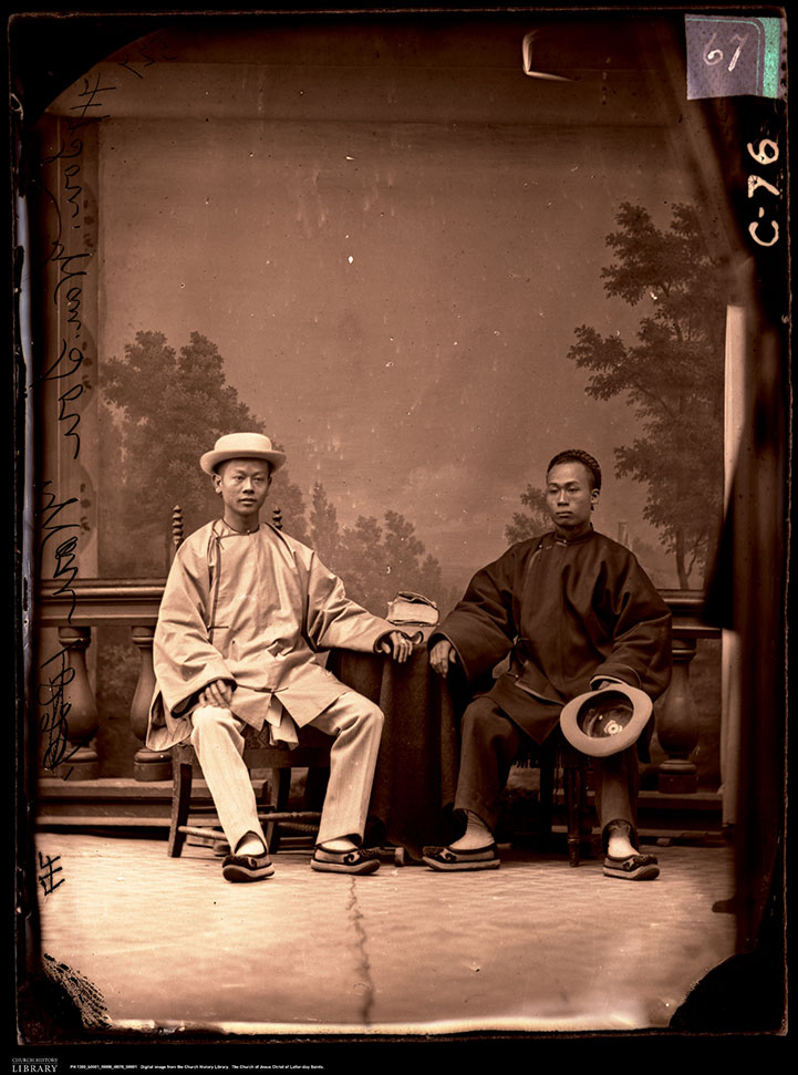
Image 64: "Utah Plain Dealer" newspaper, Salt Lake City, Utah; January 9, 1897; Courtesy of the Church History Library, Church of Jesus Christ of Latter-day Saints.


Image
With a masthead that reads “Help the New Negro Industries… Peace if Possible… Justice at Any Rate,” the editor of this Salt Lake City African-American newspaper looks optimistically towards the New Year (1897) and its second year of circulation. News includes references to Fort Douglas and the coming and goings of members from the High Marine Masonic Lodge (No. 12), an African-American lodge founded in Utah in 1890 “composed of the best citizens of Salt Lake City.”

Image 65: USO (United Services Organization) African American U.S. Army dinner, Salt Lake City, circa 1942; Ray King, photographer; Salt Lake Tribune Collection, Utah State Historical Society.

Image
Image 66: Entitled "Wrights card club, 313 East 8th South, April 27, 1945," this is one of handful of African American social clubs held in private homes across Salt Lake City. Ray King, photographer; Salt Lake Tribune Collection; Utah State Historical Society.

Image
Image 67: 349 West North Temple Street, Salt Lake City, Utah, 1936; Tax Assessor Record # 1-2930-2, Salt Lake County Archives.

Image
Owned by a local railroad company, this house was a rental by 1936, and was given a 10% reduction in property tax due to obsolescence, and as noted in bold lettering on a re-appraisal card, “COLORED TENANTS, COND. OF HOUSE VERY POOR, POOR LOCATION - !0%.

Image 68: Matchbook cover, Coon Chicken Inn, 2950 Highland Drive, Salt Lake City, circa 1940s; Courtesy of the Jim Crow Museum of Racist Memorabilia, Ferris State University.

Image
This was a small restaurant chain which was started in Salt Lake City in 1925. The Coon Chicken Inn kept its doors open until 1957, expressing a callous disregard for the city’s African-American community.
Image 69: Front cover and page 63 of the "The Negro Travelers’ Green Book," Victor H. Green [author and publisher}, New York, New York, 1956; University of South Carolina, Digital Collections.

Image

Image
The annual guide included listings for hotels, motels, tourist homes, and restaurants, located throughout the United States, where African-Americans could stay safely and un-harassed. Frequently Africans-American were owners and/or operators of these listed establishments.Three of the four places listed in Salt Lake City in 1957 were located on West South Temple, between the Greyhound Bus Station to the east and the Union Pacific Depot to the west.

Image 71: Open Hearth Coffee House, Greek Town, Salt Lake City, circa 1915-1920; photographer unknown, Utah State Historical Society.

Image
Emanuel Katsanevas stands prominently (third from left) as proprietor, his dog and its water bowl beneath him, at his Greek Town coffee house. This and numerous other coffee houses were where Greek railroad workers and miners drank coffee, smoked, played cards, and read newspapers from Greece and from Utah. Greek American newspapers published in Salt Lake City included "To Fos (The Light)" and "Oevzone."
Image 72: Salt Lake City Greek School, school graduation ceremony photograph, mid 1920s; Holy Trinity Greek Orthodox Church, 279 South 300 West; Helen Z. Papanikolas Collection, Utah State Historical Society.
Image

With the over 70 children graduating, are teachers Helen Hallori (far left) and Mrs. John Varanakis (far right). They are joined by school committee members (top row, left to right), Mike Varonakis, William Souvall and George Tountas. The Holy Trinity Church is the backdrop for this group portrait taken in 1923.

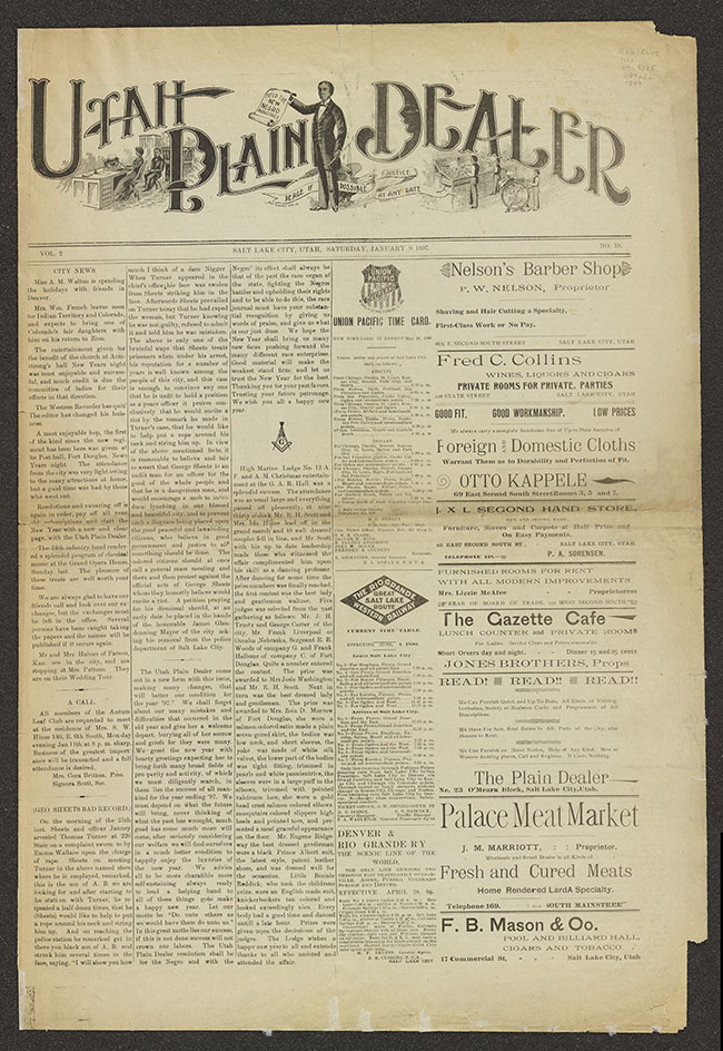
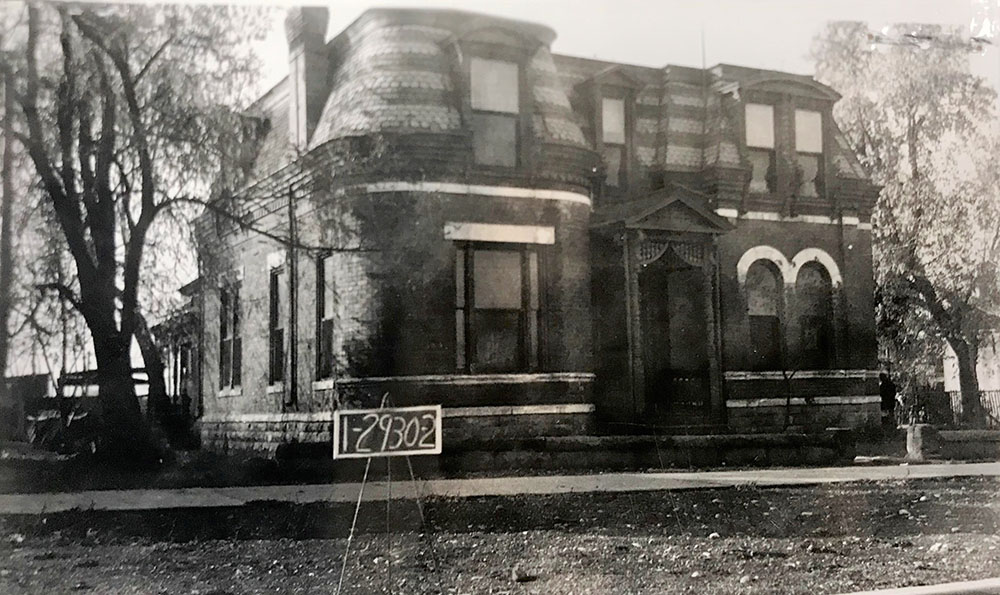
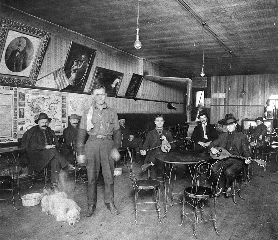
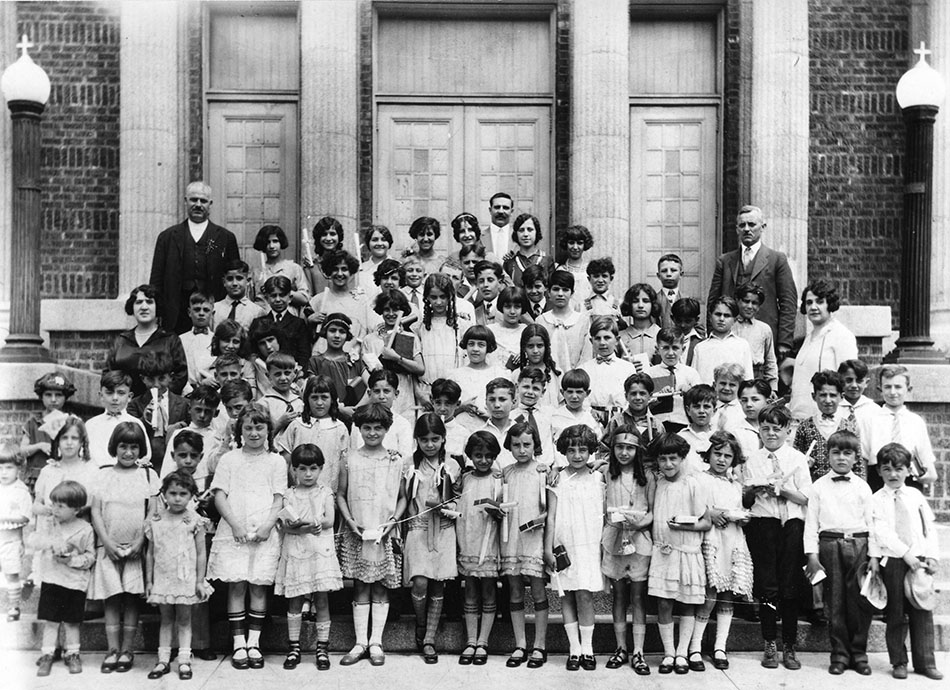
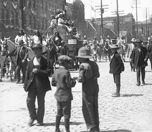
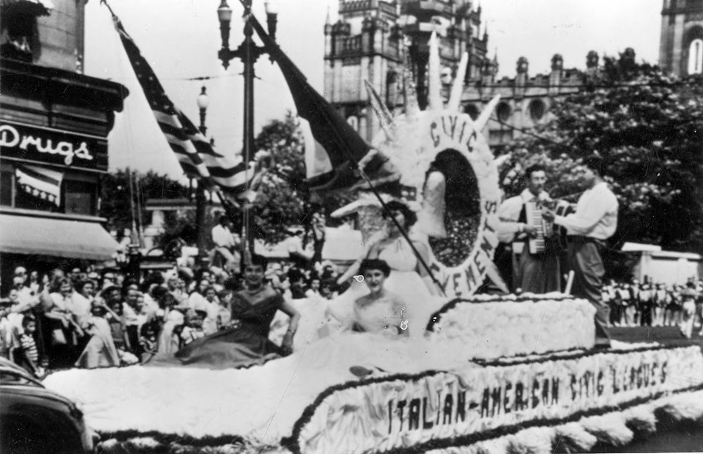
Image 73: Parade float of Societa di Cristoro, Salt Lake City, July 24th Pioneer Day Parade, 1924; photographer unknown, J. Willard Marriott Library, University of Utah.


Image
Following the theme of “pioneers,” Salt Lake City’s Italian Americans chose to celebrate and honor, not the 1847 Utah pioneers, but one of America's so called first European pioneers of 1492, Christopher Columbus. Although now deeply offensive to Native Americans (Columbus and Columbus Day), to the Utah's Italian Americans, this float proffered the point that they had a pioneer that long preceded the Mormon Pioneers.

Image 74: Los Angeles Hotel and Bar, 377 West South Temple, 1936, owned by Dominico Conta and Guiseppe Fernando; Tax Assessor Records, Series: 82484, envelope 1-2876, Salt Lake County Archives.

Image
The image includes the nameless assessor’s office employee crouching and holding a chalkboard identifier, left of center. It also includes a billboard advertising Joel McCrea and Jean Arthur in the Columbia Pictures film Adventures in Manhattan (released in October 1936). The Pioneer Park neighborhood had scores of similar small hotels like the Los Angeles Hotel, owned and operated by Italian American partners Dominico Conta and Guiseppe Fernando. The first-floor bar served “on tap” Utah’s own Fisher and Becker Beers, with sleeping rooms upstairs and in the rear for rent for 50 to 75 cents a night.
Image 75: Toddlers of Japanese American farmers, Keetley, Wasatch County, Utah; June, 1942; Salt Lake Tribune, Utah State Historical Society.

Image
Expressing equal remoteness and human interest, this group of toddlers along with their parents and siblings, lived in self-imposed rural isolation, on leased farmland twelve miles north of Heber, Utah (now under the Jordenelle Reservoir). Besides thousands of Japanese Americans incarcerated in Utah’s Topaz Internment Camp, a voluntary group of California Japanese lived and farmed on lands leased by California businessman and philanthropist Fred Wada.
Image 76: Japanese American US Army Servicemen in Utah, during World War II, July 1944; Salt Lake Tribune Collection, Utah State Historical Society.

Image
Wearing service ribbons with combat stars, these four unidentified soldiers were photographed in Utah in a moment of comradery and laughter. The two seated have visible service ribbons and are wearing Asiatic Pacific Campaign ribbons, the one on the left an amputee. Nisei or U.S. born Japanese Americans in early 1943, were able to enlist (serving as the 442 Infantry Regiment, they fought across European from 1944 to 1945, and became the most decorated unit in U.S. military history). In Hawaii prior to this, the U.S. Army Reserve, made up predominantly Japanese Americans, became the 100th Infantry Battalion and began service in late 1942. The US Army’s MIS (Military Intelligence Service) also had hundreds of Japanese American serving in forward areas as translators, interpreters, and interrogators. Finally, the U.S. Army Bushnell General Military Hospital in Brigham City (opened 1942 to mid-1946), cared for scores of wounded Japanese American servicemen, all from the units mentioned above. It is likely while travelling from Bushnell (or while in Bushnell), that these servicemen were photographed.

Image 77: Funeral gathering in front of Japanese Buddhist Temple, between 200 and 300 West on 100 South, Salt Lake City, Utah, March 21, 1949; Shipler Commercial Photography, Utah State Historical Society.

Image
Over two hundred and fifteen Utahns of Japanese descent—men, women and children, attending a funeral and paying their last respects—are captured in this panoramic photograph.
Image 78: Salt Lake City bowling team sponsored Okada Insurance Company, attending the Japanese American Citizen League (JACL) Holiday Bowl Bowling Tournament, Los Angeles, California, 1959; photographer unknown, Utah State Historical Society.

Image
The team included (left to right) Pap Miya, Chas Sonoda, Wataru Misaka, Dr. Jun Kurumada, and Ken Takeno. Misaka (third from left) known as “Wat,” was from Ogden, Utah, lead the University of Utah Utes to two national championships in the mid-1940s, before becoming the NBA’s first non-while and Asian basketball player in 1947 and 1948. This at the same time Jackie Robinson, was breaking the color line in major league baseball. Further national and state recognition for “Kilowatt” Misaka is warranted.
Image 79: Buddhist Temple Ochigo Parade, held on 100 South Street, Salt Lake City, Utah, 1962; Courtesy of the Densho Digital Repository.

Image
The “Ochigo,” or Buddhist children’s “precession of festivity,” includes children strolling in authentic historical costumes and makeup. The parade ended at the Salt Lake City Buddhist Temple, on 100 South and on the corner of 200 West.

Image 80: Membership of the Japanese Church of Christ (251 West 100 South), circa 1965; Helen Z. Papanikolas Collection, Utah State Historical Society.

Image
The photograph was taken amid urban renewal efforts to condemn by imminent domain, then buy and raze, the surrounding Japan Town. This church, an adjacent Japanese garden to the east, and the Salt Lake Buddhist Temple across the street to the southeast, are all that remain of this once vibrant Japanese community.
Image 81: Roman Catholic Summer school at the Guadalupe Mission, 524-528 West 400 South, Salt Lake City, Utah, 1934; Sylvia Mayo Collection, Utah State Historical Society.
Image
A summer school (mid-June to mid-August) for the Pioneer Park neighborhood was started in 1928. Later it was directed by Father James E. Collins, who remained with the mission and later parish for 27 years. In the 1930s average attendance of Mexican American children—along with many non-Catholic West-side children—was 250 children a day. Father Collins is seated in the center third row left, next to him is Bishop James E. Kearney (Bishop of Salt Lake City 1932–1937). With the widening of the 400 South viaduct, the Guadalupe Mission moved its operations in 1970.

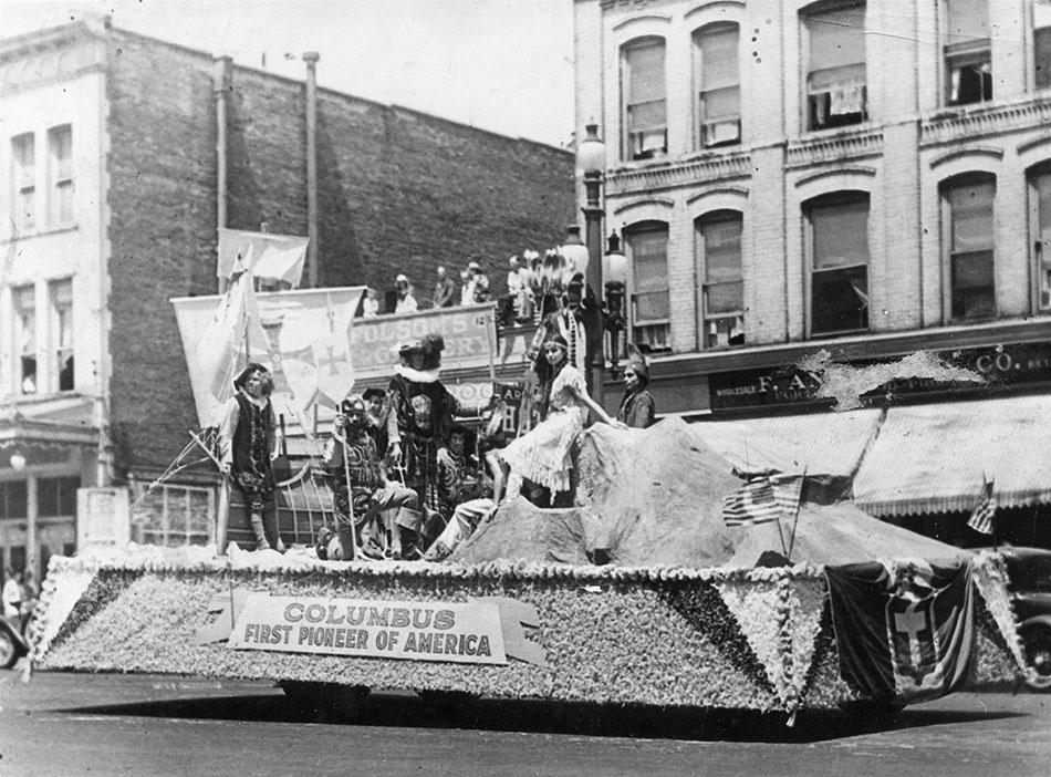
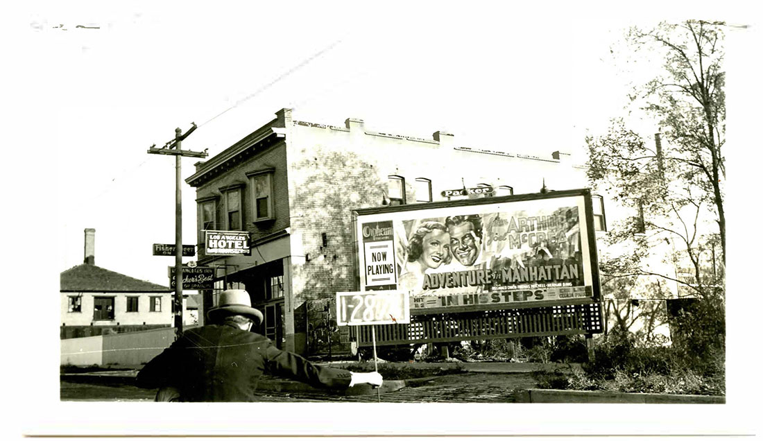
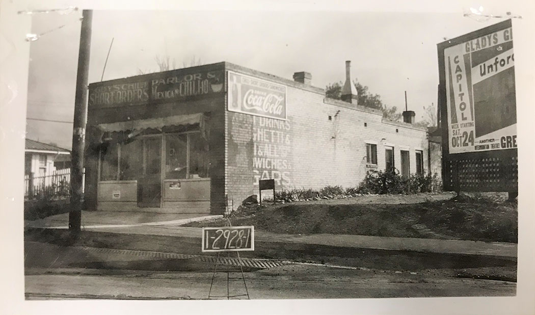
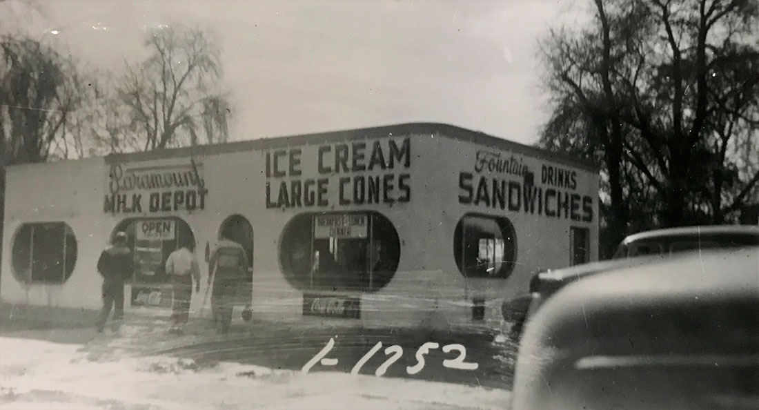
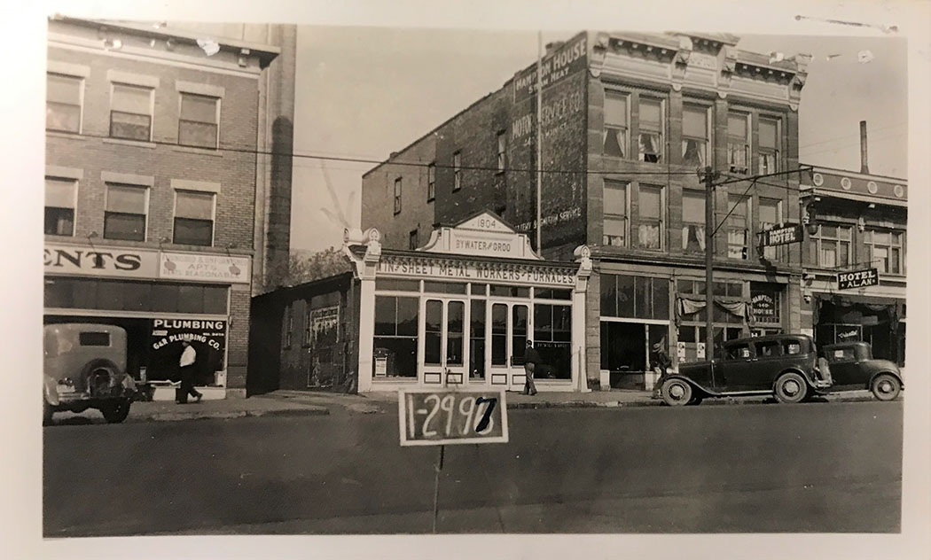
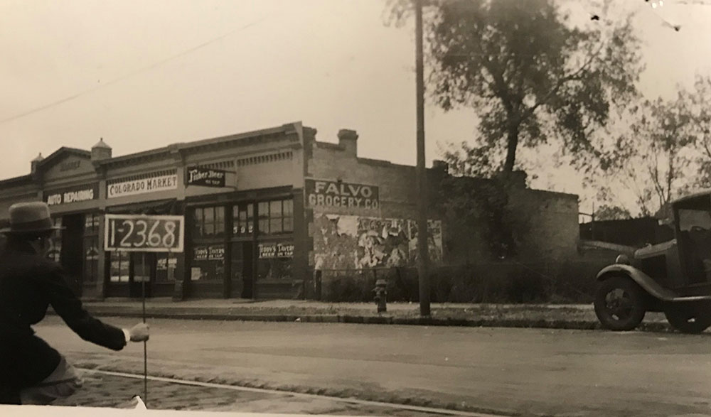
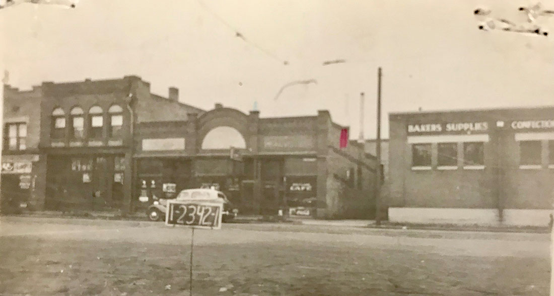
Image 82: The following five photos are snap shots of Salt Lake City’s West side markets, bakery, markets and cafes, circa 1930-1940; Tax Assessor Records 1-1198, 1-1739, 1-2968-71, 1-2928 and 1-1752, Salt Lake County Archives.


Image
The West side was a neighborhood of ethnic communities which often included many “mom and pop” corner stores, markets and cafes. Salt Lake County’s tax (accessor) snap shots were taken so the assessors could better determine property values.Today they offer a rare glimpse into the small businesses that once dotted the Pioneer Park neighborhood.This photo is of Snarr Bakery on 324 West 600 South (photo #1).

Image 83: Pioneer Park Cafe, 365 West, 400 South, Salt Lake City, (photo #2). Located across the street south from Pioneer Park there is still a restuarant on this lot.

Image

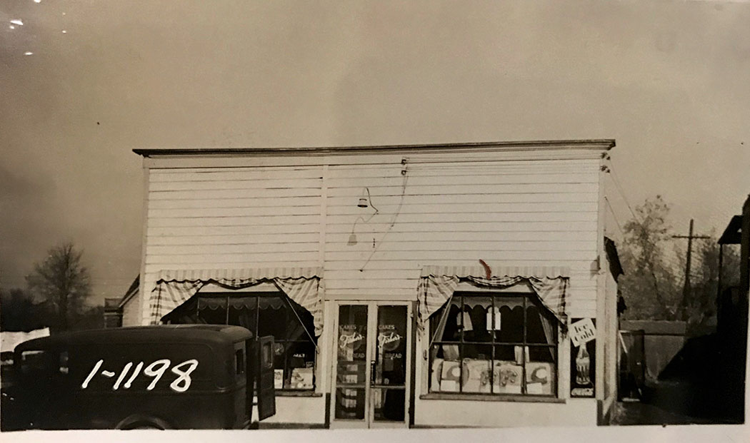
Image 84: The Step Inn located on the edge of an apartment complex at 200 West 23 North (just off of South Temple (photo #3).


Image

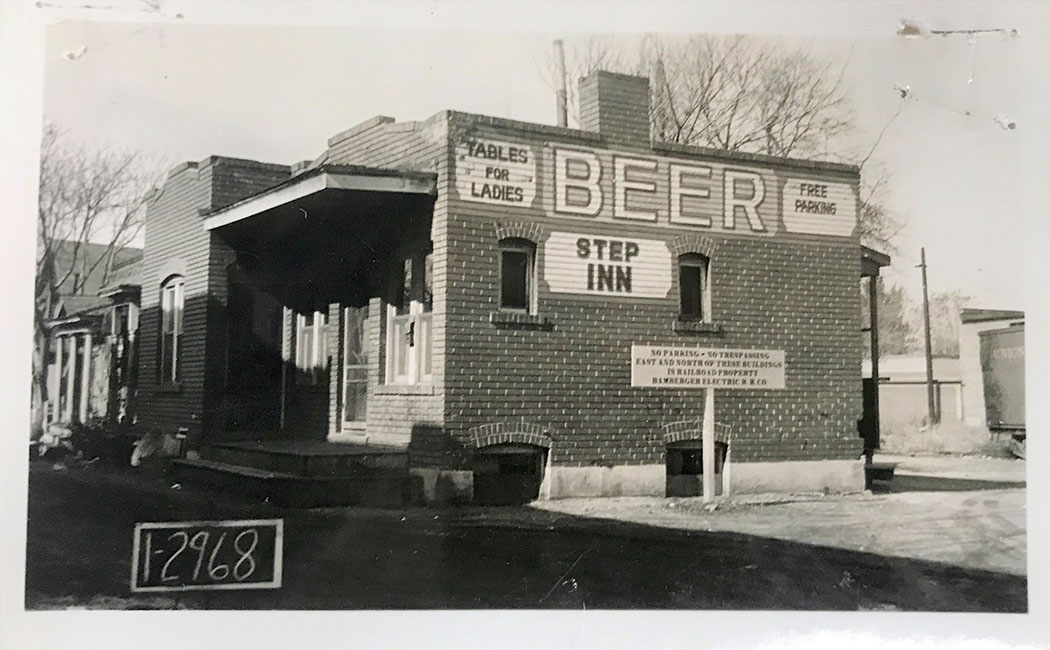
Image 85: Guy’s Mexica Chili and Short Order on 66 North 400 West (photo #4).


Image

Image 86: The Milk Depot on 434 South 200 West (photo #5).

Image
Image 87: Metropolitan Water District's Water Exhibit (Come In! No Charge), Deer Creek Reservoir and Aqueduct, State Street storefront, November 25, 1937; Clifton Bray Collection, Utah State Historical Society.

Image
With the construction of Deer Creek Reservoir (1938-1941), along with the building of an aqueduct and the expansion of canals, new culinary waters splashed into Salt Lake Valley. These waters previously had drained into Utah and Ogden valleys and eastward into the Colorado River Basin. By the 1970s—some thirty years later—due to the aforementioned cheap water, an ever expanding automobile culture, the loss of city-based industries, and growth of suburban retail and commerce, Salt Lake City slipped into economic decline. This was not unlike other American cities that struggled during the second half of the 20th century to hold their populations and economic vibrancy.
Image 88: Hotel Utah Motor Lodge & Crossroads Café, 40-90 North West Temple Street, Salt Lake City; 1958-1962; Hotel Utah Collection, University of Utah Special Collections.

Image
Striving to meet the changing needs of the mid-20th century travelers, the LDS Church and its Hotel Utah Corporation built in 1958—west across from Temple Square—a 150 unit motel, café and exhibit hall. In the mid 1980s the LDS Church's Family History Library and Church History Museum were built where this motor lodge once stood. Amenities included door-side parking, a heated swimming pool, air conditioning and a black and white television in each room.

Image 89: Hotel Utah Motor Lodge in all its mid-century glory, circa 1964. Courtesy of the University of Utah Special Collections.

Image
The influence of automobile culture and the allure of suburbia, compelled Hotel Utah owners to offer their guests a roadside hotel designed specifically for motorists, with dramatic signage (the street sign with a glowing beehive), a grand glass filled entrance and a bright cafe appropriately named the "Crossroads Café."
Image 90: Hotel Utah Motor Lodge in color, with Temple Square across the street, circa 1970. Courtesy of the University of Utah Special Collections.
Image

Image 91: Scrapbook, LGBTQ+ Salt Lake City Community, University of Utah Special Collections Library.

Image
The scrapbook ducuments gatherings and protests in Salt Lake City during the mid-1990s. It also includes photographs taken at the April 25, 1993 "March on Washington," including a large contingent of Utahns who marched with the banner "Utah Lesbians, Gays and Bisexuals."

Image 92: Salt Lake City's Sun Tavern served as de facto gathering place of LGBTQ+ Salt Lakers for years. The ad was published in the University of Utah's "Daily Utah Chronicle." Courtesy of the University of Utah.

Image
Image 93: Union Pacific freight train, going north on 400 West tracks, circa mid 1940s; Emil-Albrecht photographer; courtesy of Don Strack and UtahRails.net.

Image
Railroads and all its associated industries and social conditions have been a part of the Pioneer Park neighborhood for over 150 years. Although still a part of contemporary life, other factors are now in the balance, influencing Salt Lake City’s old west side. Taken at the intersection of 400 South and 400 West, this photograph looks north towards the Union Pacific Depot on South Temple. Pioneer Park and its police kiosk are to the right. From 1870 when the first trains came to Salt Lake City to the 1980s, multiple rail and trolley tracks passed north, west and south of Pioneer Park.

Image 94: Salt Lake City’s Broadway Street (300 South) looking west to the Rio Grande Depot, a hazy end of summer day, September 2018; courtesy of the author.

Image
The image was taken near the northwest corner of Pioneer Park, where our serial history began. Salt Lake City's old west side or the Pioneer Park neighborhood was first home to Utah’s ancient inhabitants, then as part of the ancestral lands of Utah’s native tribes, then since 1847 as a base camp for wave after wave of different Utah pioneers, who have all laid claim to "Life, Liberty and the pursuit of Happiness."
Image 95: Homeless campers on 500 West, behind the Rio Grande Depot, circa 2017; Courtesy of the Salt Lake Tribune.

Image
Taken just before the launch of “Operation Rio Grande,” where hundreds of Utah Highway Patrol and SLC Police officers began prohibiting camping around the city’s homeless shelters, numbers ranging near a thousand people were camping within a two block radius centered on the Rio Grande station (300 South Rio Grande Street).